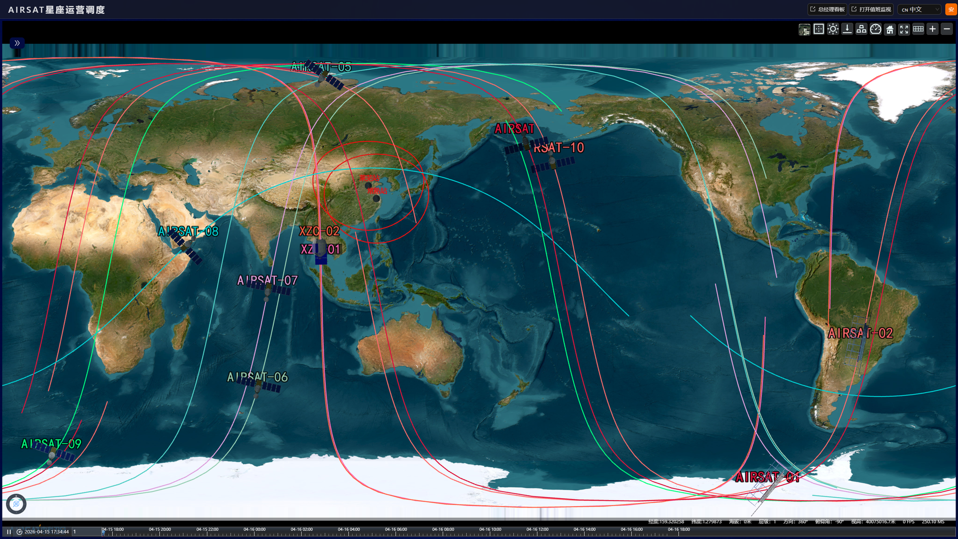
12 Satellites In Orbit · 40-Sat Target by 2028

WE MAKE SPACE YOURS

Asia-Pacific's leading commercial X/Ku-band SAR constellation operator — delivering all-weather, all-time Earth observation data and intelligent geospatial solutions to industries and enterprises worldwide.

12Satellites in Orbit
0.5mSpotlight Resolution
40minFastest Capture-to-Delivery
<1hAverage Revisit
Why AIRSAT

Full-Chain Capability Under One Roof

Unlike pure data resellers, AIRSAT designs and manufactures its own satellites, operates its own ground station network, and runs its own AI interpretation pipeline — with 4 regional delivery centers for localized services.

1

SAR Payload R&D

World-first Cassegrain dual-reflector SAR antenna. X-band multi-polarization, sub-meter resolution, multiple imaging modes.

2

Satellite Engineering

End-to-end satellite system development: bus design, payload integration, ground segment, and application systems.

3

Constellation Operation

Multi-satellite intelligent TT&C, mission planning, global data reception, and long-term on-orbit management.

4

Geospatial Services

Standard data products, InSAR deformation monitoring, AI-driven change detection, and industry-specific solutions.

Solutions That Work When Optical Sensors Can't

Our SAR data and solutions serve a wide range of sectors — from precision agriculture to infrastructure safety, from environmental protection to maritime surveillance.

Disaster Response

24/7 emergency tasking; SAR penetrates cloud, smoke and darkness. Deliverables available within 4–24 hours of activation.

Read More

Agriculture & Forestry

All-weather crop monitoring with >90% classification accuracy; flood damage assessment; soil moisture and infrastructure monitoring.

Read More

Natural Resources

Full-lifecycle mining monitoring: subsidence, tailings dam safety, slope stability, power corridors, and ESG reporting.

Read More

Urban Infrastructure

Transportation infrastructure, construction progress, unauthorized construction detection, and urban flood hydrological modeling.

Read More

Maritime & Ocean

All-weather maritime surveillance for oil spill, vessel detection, IUU fishing, aquaculture, and harmful algal bloom monitoring.

Read More

Environmental Protection

Land cover change, water quality, wetland and coastal ecosystem monitoring, and environmental compliance verification for regulators and conservation bodies.

Read More

Ready to Access AIRSAT Satellite Data?

Contact our international business team for data licensing, custom solutions, or strategic partnership opportunities.

News & Milestones

Company news, press releases and programme updates will be published here.

Content Coming Soon

News items are being prepared together with the company and will be published on this page.

View All